From Point Clouds to Forest Inventories
Made for Forests
When it comes to analyzing forests and vegetation, LiDAR data is hard to beat.
Unlike traditional aerial imagery, LiDAR actively measures the forest in three dimensions. Laser pulses pass through gaps in the canopy, recording multiple returns from leaves, branches, stems, and the ground below. The result is a detailed 3D picture of your forest - tree by tree, layer by layer.
This makes it possible to do much more than just map the canopy surface. You can analyze vertical forest structure, estimate tree heights directly from the data, and even detect individual stems in dense stands. At the same time, LiDAR provides a precise ground surface model - essential for slope, terrain, and accessibility analysis.
In this post, we’ll show how LIS Pro 3D helps you turn LiDAR data into practical forestry insights: mapping individual trees and deriving key inventory metrics in a clear, step-by-step workflow - no prior LiDAR experience required.
Everything Starts with Classification
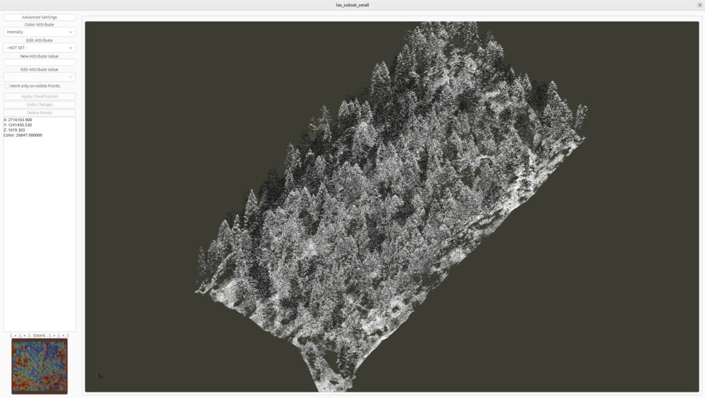
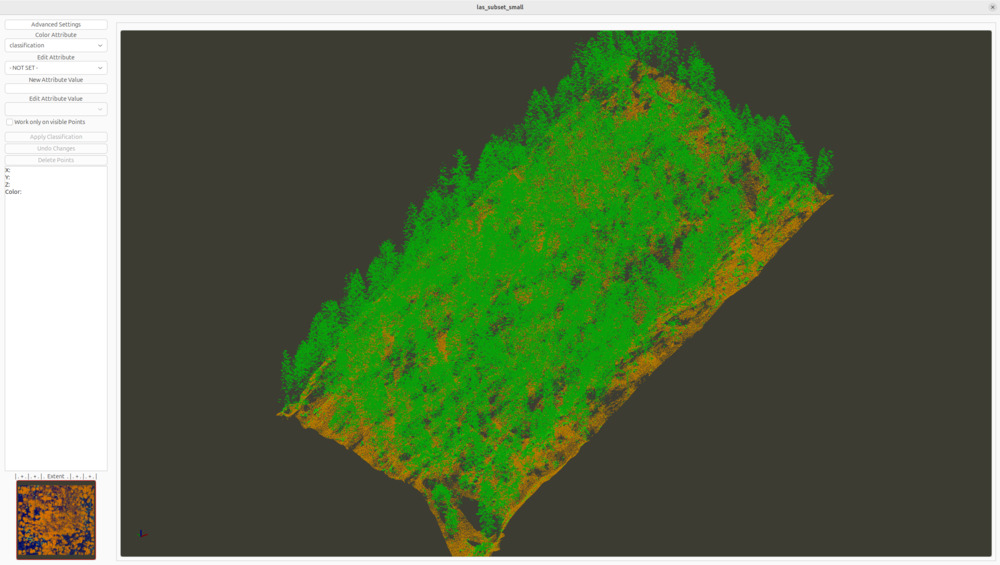
A raw point cloud is often just that - a dense collection of points with no immediate meaning. Before you can analyze forests, terrain, or infrastructure, this data needs structure.
This is where LIS Pro 3D comes in. By classifying the raw data, it separates vegetation from other objects and assigns each point a height above ground. Suddenly, the point cloud becomes readable, measurable, and ready for analysis.
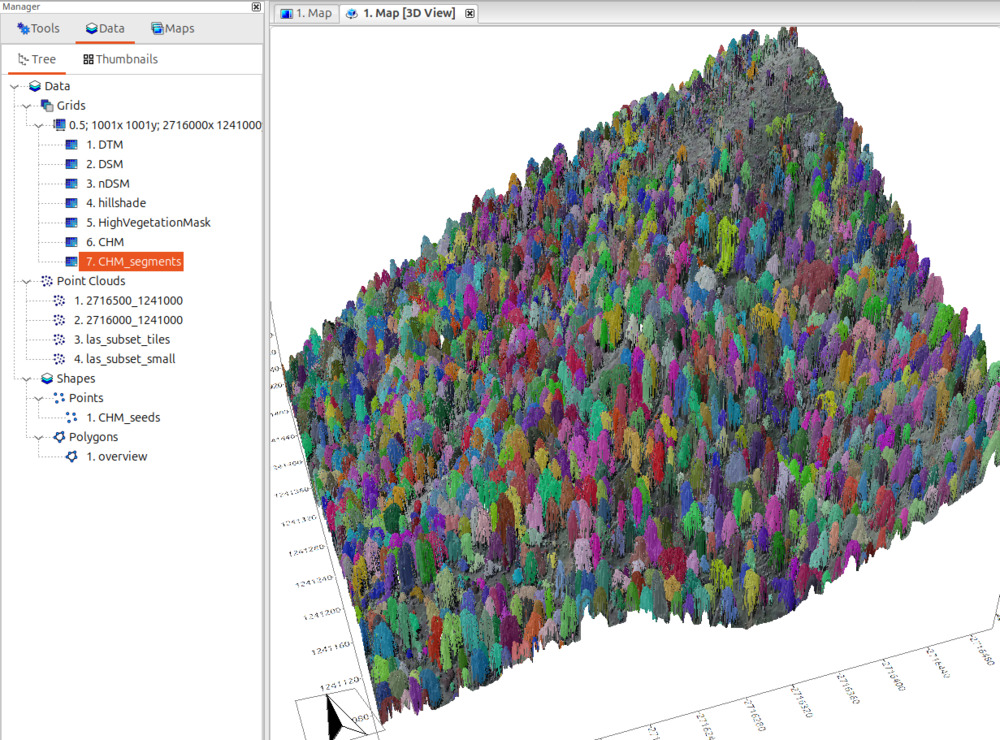
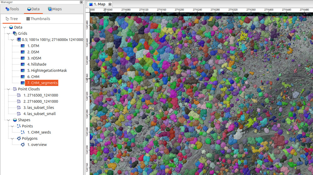
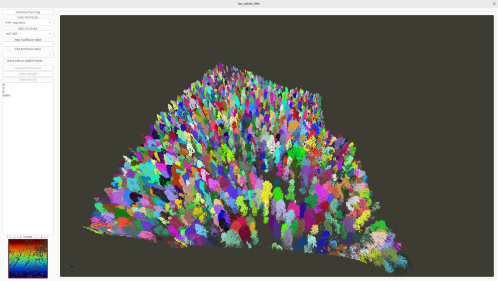
Map your Trees
But don’t stop at classification. Go one step further and map individual trees - including their location, height, and crown extent.
With LIS Pro 3D, segmented trees become clearly defined objects you can analyze, visualize, and use for inventory and planning tasks.
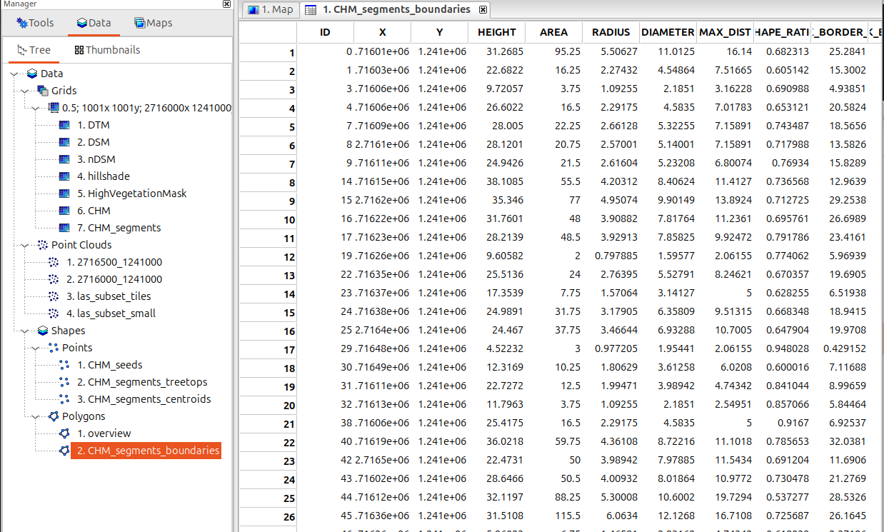
The Metrics You’re Looking For
This is where analysis turns into insight. Once trees are segmented, you can start working with them as individual objects.
Assign each tree a unique identifier, determine its precise geographic position, and derive key attributes such as tree height, crown area, and crown radius - the metrics you need for forest inventory, planning, and monitoring.
What’s Next?
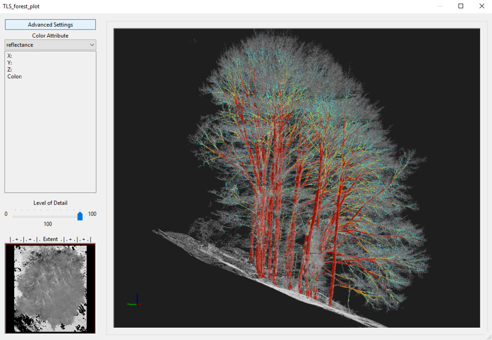
LiDAR technology is evolving fast. Today, terrestrial laser scanning and drone-based laser scanning already enable highly detailed forest analyses at the plot and stand level.
As future airborne datasets continue to improve in resolution and accuracy, even more advanced analyses will become possible - opening new opportunities for precision forestry, long-term monitoring, and data-driven decision-making.
Start Learning Today
Explore the forestry tutorial section and see how easy it is to go from raw point cloud data to forest inventory data.
- Request your free LIS Pro 3D trial here
- Get started with our ALS Forestry tutorial