Analysis
From Unstructured Data to Reliable Results
Point clouds are inherently unstructured datasets, and meaningful analysis typically involves a sequence of processing steps. Before final results can be derived, intermediate calculations are often required to enrich the dataset with additional information. These attributes can be computed either per point or for groups of points.
Geometric Point Cloud Features
For individual points, nearest-neighbor queries are commonly used to calculate new attribute values - so-called features - based on the local neighborhood of each point. Examples include geometric features such as linearity or planarity, derived from eigenvalue analysis of the local covariance matrix. These descriptors indicate whether the surrounding point distribution follows a predominantly linear or planar pattern as illustrated in the figure below. Such features form the basis for subsequent feature extraction tasks, for example detecting pole-like structures or other linear elements within the data.
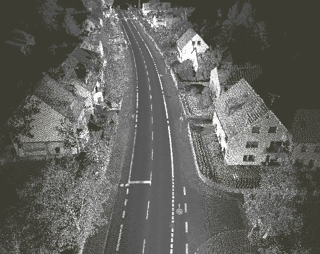
Point cloud colored by intensity
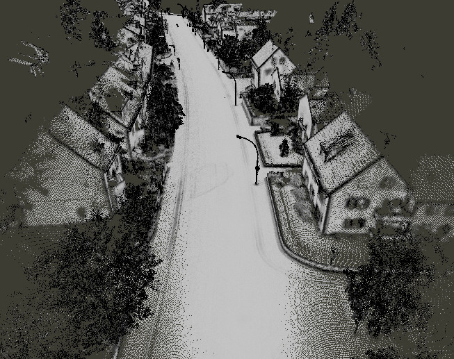
Point cloud colored by planarity
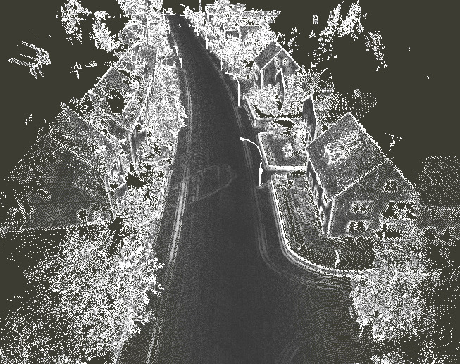
Point cloud colored by linearity
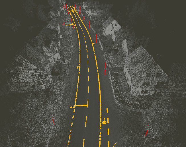
Extraction of specific objects by using geometric features
Segmentation - Grouping Similar Points by Attributes or Geometry
Another essential analysis step is segmentation, where the point cloud is partitioned into clusters of points with similar properties. Segmentation can be performed purely in attribute space - using intensity or color values for example - or by incorporating geometric information. A common geometric approach is plane fitting, which groups neighboring points that belong to the same planar surface. This method can be used, for example, to identify individual roof planes of a building. Once segmented, these roof planes can be analyzed further to determine their orientation or to generate detailed 3D building models.
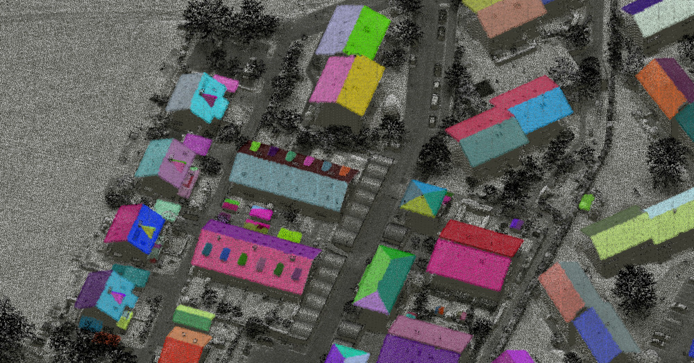
Roof segmentation
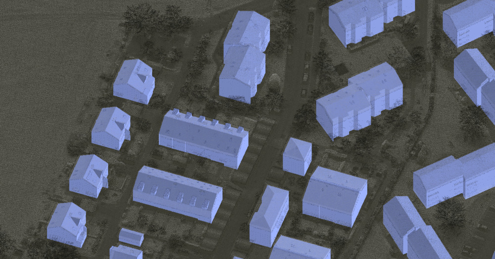
3D Building models
Reliable Classification as the Foundation for Advanced Workflows
Classification is another key component of many point cloud workflows. Depending on the project requirements, a simple separation into ground and non-ground points may be sufficient. In more advanced applications, additional classes such as buildings, vegetation, power lines, or pylons are required. Accurate classification enables targeted analyses, such as assessing vegetation encroachment along power lines or conducting detailed forestry evaluations including single-tree segmentation and the calculation of tree-specific attributes such as height and crown area.
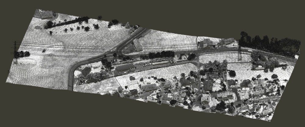
Unclassified point cloud coloured by intensity
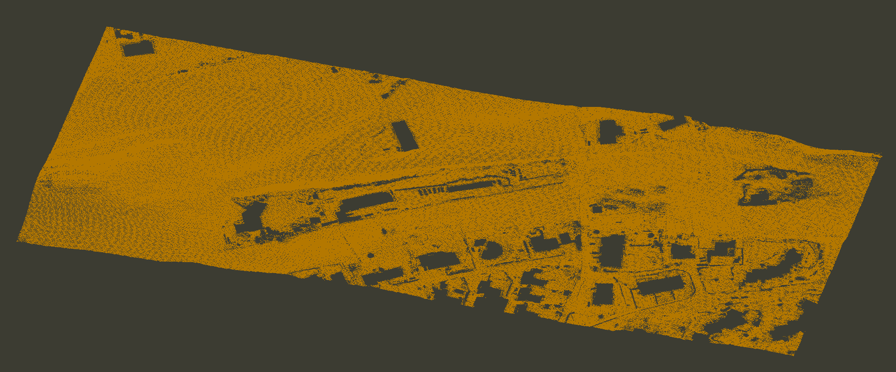
Classified ground points
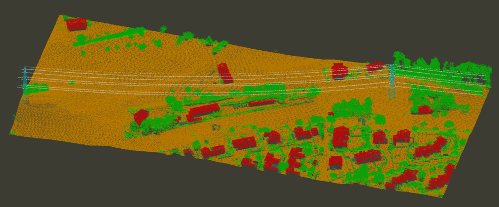
Fully classified point cloud
LIS Pro 3D at Every Stage
LIS Pro 3D provides a comprehensive suite of analysis tools, ranging from specialized feature computation tools to advanced workflows operating on fully enriched datasets (e.g., including normal vectors or segment identifiers). Dedicated add-ons address domain-specific applications such as geotechnical analysis, forestry, and automated 3D building model generation.
- Check out LIS Pro 3D’s processing capabilities and use cases
- Explore our tutorials for deeper insights